
 {Eric Fischer makes this city map art using Flickr geotags, article found on fastcompany}
These info graphic images of photo maps look tactile, like fine Washi papers from Japan. That is what caught my eye when I was checking out fastcompany.com for the latest in design. The geotags tell where people took photos in major cities of interest. Fischer showcases 50. He can even compare tourists habits with locals and the results are amazing. I just love how textured they look. Check out the article on fastcompany! To see them on Fischer's flickr click here.
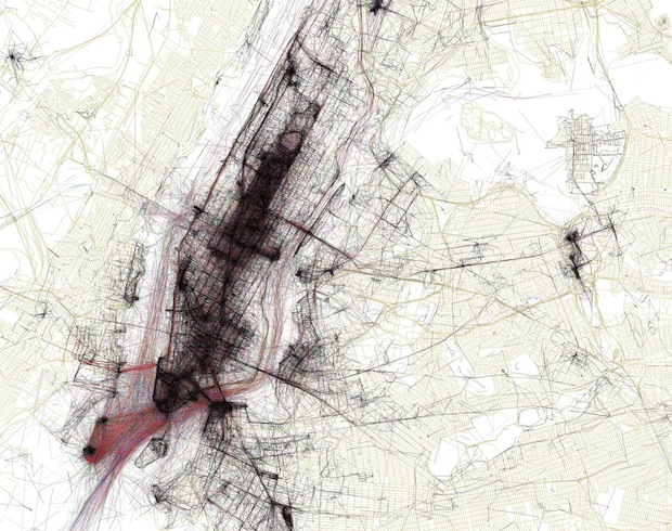
To decode the web of points and lines:
black is walking
red: bicycling or equivalent speed
blue: local photos, motor vehicle or normal road use
red: tourists or people who took pictures here for a short time span
yellow: local or tourist status can't be determined
green: is freeway or rapid transit
If you zoom in on flickr, you can actually see so much more detail. The true algorithm is not divulged, but the visual is so intriguing. What do you think?
If you zoom in on flickr, you can actually see so much more detail. The true algorithm is not divulged, but the visual is so intriguing. What do you think?


No comments:
Post a Comment